
- EMOM - Kid's Virtual Mother
Directions

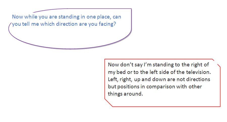
Let me ask you a question. But for that you will have to stand up.
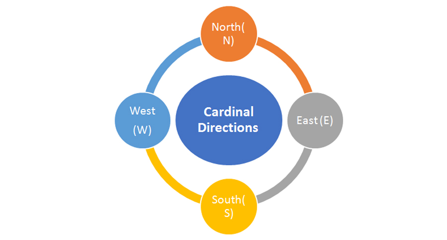
The four directions are: North, South, East and West.
North and South face each other.
East and West face each other.
West is to the left of north and east is to the right of north.
Now can you re-think and tell me which direction are you facing when you stand up?
You still wouldn’t know. But here is an easy way to find out:
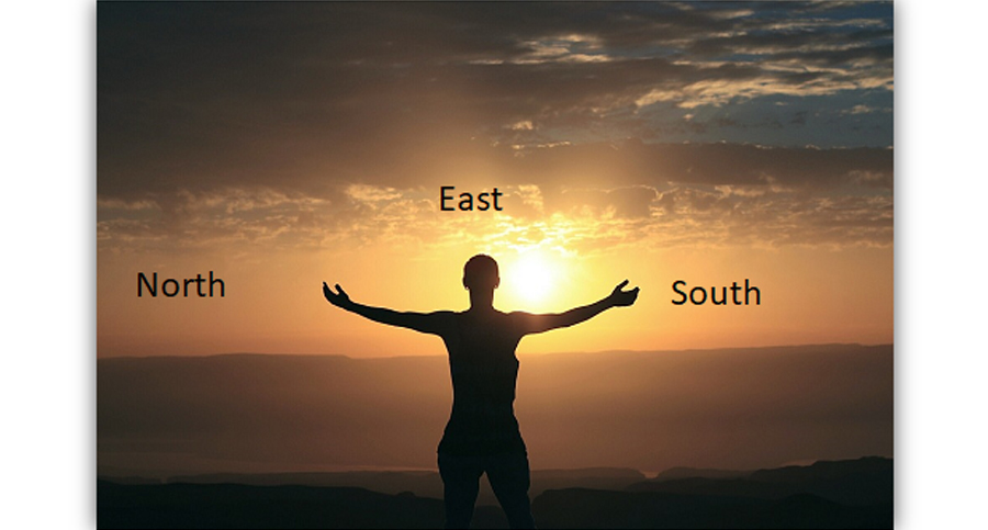
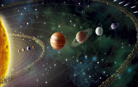
- The Sun always rises from the east and sets in the west.
- So, if you know which direction the sun rises in the morning, that is the East.
- If you stand facing East, exactly opposite East and behind you will be West.
- Stretch your hands horizontally. Your left hand will face North, and right hand will face south.
Easy Breezy!! Wasn’t it??
Direction is used to determine where things are in relation to other things. For geographic purposes, direction is more specific.
Cardinal Directions:
Cardinal Directions are the most commonly used forms of direction. The four cardinal directions, or cardinal points, are the directions north, east, south, and west, commonly denoted by their initials N, E, S, and W. East and west are perpendicular (at right angles) to north and south, with east being in the clockwise direction of rotation from north and west being directly opposite east. Points between the cardinal directions form the points of the compass.
The intercardinal (also called the intermediate directions and, historically, ordinal) directions are northeast (NE), southeast (SE), southwest (SW), and northwest (NW).
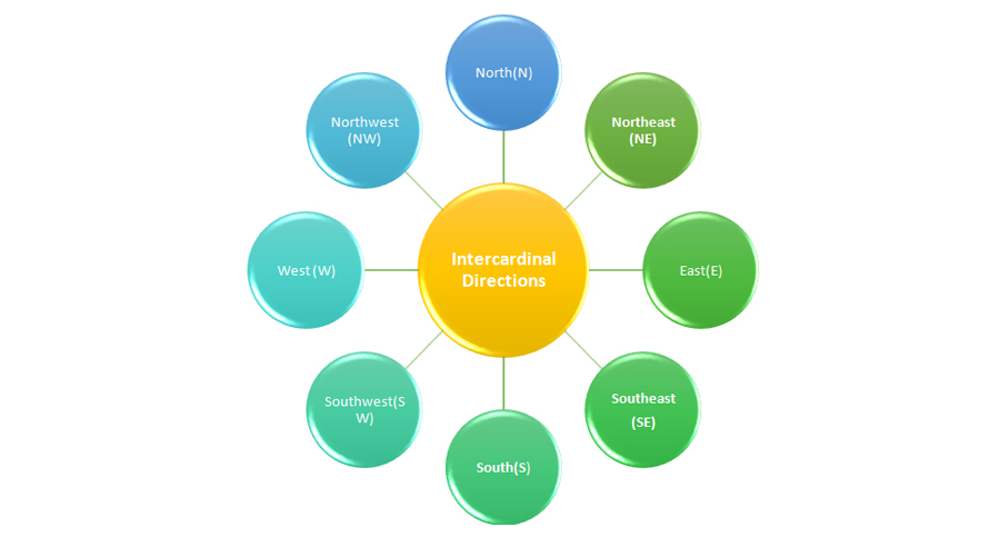
The intermediate direction of every set of intercardinal and cardinal direction is called a secondary intercardinal direction, the eight shortest points in the compass rose that is shown to the right (e.g. NNE, ENE, and ESE).
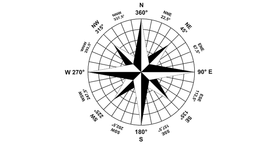
A compass rose showing the four cardinal directions, the four intercardinal directions, and eight more divisions.
Cardinal points (in degrees):
The directional names are routinely associated with the degrees of rotation in the unit circle, a necessary step for navigational calculations (derived from trigonometry) and/or for use with Global Positioning Satellite (GPS) receivers. The four cardinal directions correspond to the following degrees of a compass:
| Directions | In Degree |
|---|---|
| North(N) | 0° = 360° |
| East(E) | 90° |
| South(S) | 180° |
| West(W) | 270° |
Intercardinal directions in degrees:
The intercardinal directions are the four intermediate compass directions located halfway between each pair of cardinal directions.
| Directions | In Degree |
|---|---|
| Northeast (NE) | 45° |
| Southeast (SE) | 135° |
| Southwest (SW) | 225° |
| Northwest (NW) | 315° |
Locating the direction:
| Ways to locate direction | Description |
|---|---|
 The Sun The Sun |
1. The position of the Sun in the sky can be used for orientation if the general time of day is known. 2. In the morning the Sun rises roughly in the east and tracks upwards. 3. In the evening it sets in the west, again roughly and only due west exactly on the equinoxes. |
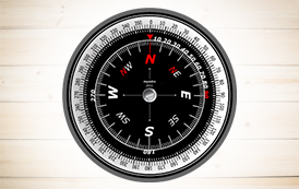
 Magnetic Compass Magnetic Compass |
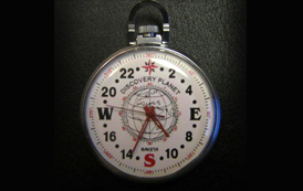
1. The Earth has a magnetic field which is approximately aligned with its axis of rotation. 2. A magnetic compass is a device that uses this field to determine the cardinal directions. 3. Magnetic compasses are widely used, but only moderately accurate. 4. The north pole of the magnetic needle points towards the geographic north pole of the earth and vice versa. |
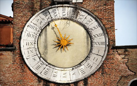
 Watch Dial Watch Dial |
1. There is a traditional method by which an analogue watch can be used to locate north and south. 2. The Sun appears to move in the sky over a 24-hour period while the hour hand of a 12-hour clock dial takes twelve hours to complete one rotation. 3. In the northern hemisphere, if the watch is rotated so that the hour hand points toward the Sun, the point halfway between the hour hand and 12 o’clock will indicate south. 4. For this method to work in the southern hemisphere, the 12 is pointed toward the Sun and the point halfway between the hour hand and 12 o’clock will indicate north. |
 Sundial Sundial |
1. A portable sundial can be used as a more accurate instrument than a watch for determining the cardinal directions. 2. Since the design of a sundial takes account of the latitude of the observer, it can be used at any latitude. |
 Astronomy Astronomy |
1. Astronomy provides a method for finding direction at night. 2. All the stars appear to lie on the imaginary Celestial sphere. 3. Because of the rotation of the Earth, the Celestial Sphere appears to rotate around an axis passing through the North and South poles of the Earth. 4. This axis intersects the Celestial Sphere at the North and South Celestial poles, which appear to the observer to lie directly above due North and South respectively on the horizon. |
 Gyrocompass Gyrocompass |
1. The gyrocompass was developed for shipboard use. 2. Since it finds true, rather than magnetic, north, it is immune to interference by local or shipboard magnetic fields |
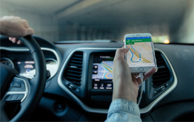 Satellite Navigation Satellite Navigation |
1. Satellite-based Global Positioning Systems (GPS) provided yet another means for any individual to determine true north accurately. 2. While GPS Receivers (GPSRs) function best with a clear view of the entire sky, they function day or night, and in all but the most severe weather. 3. There are consumer versions of the receivers that are attractively priced. 4. Since there are no periodic access fees, or other licensing charges, they have become widely used. 5. GPSR functionality is becoming more commonly added to other consumer devices such as mobile phones. |
Usefulness of Cardinal Points:
- With the cardinal points, convention cartographers draw standard maps with north (N) at the top, and east (E) at the right.
- In turn, maps provide a systematic means to record where places are, and cardinal directions are the foundation of a structure for telling someone how to find those places.
- North does not have to be at the top. Most maps in medieval Europe, for example, placed east (E) at the top.
- A few cartographers prefer south-up maps.
- Many portable GPS-based navigation computers today can be set to display maps either conventionally (N always up, E always right) or with the current instantaneous direction of travel, called the heading, always up.
EMOM


